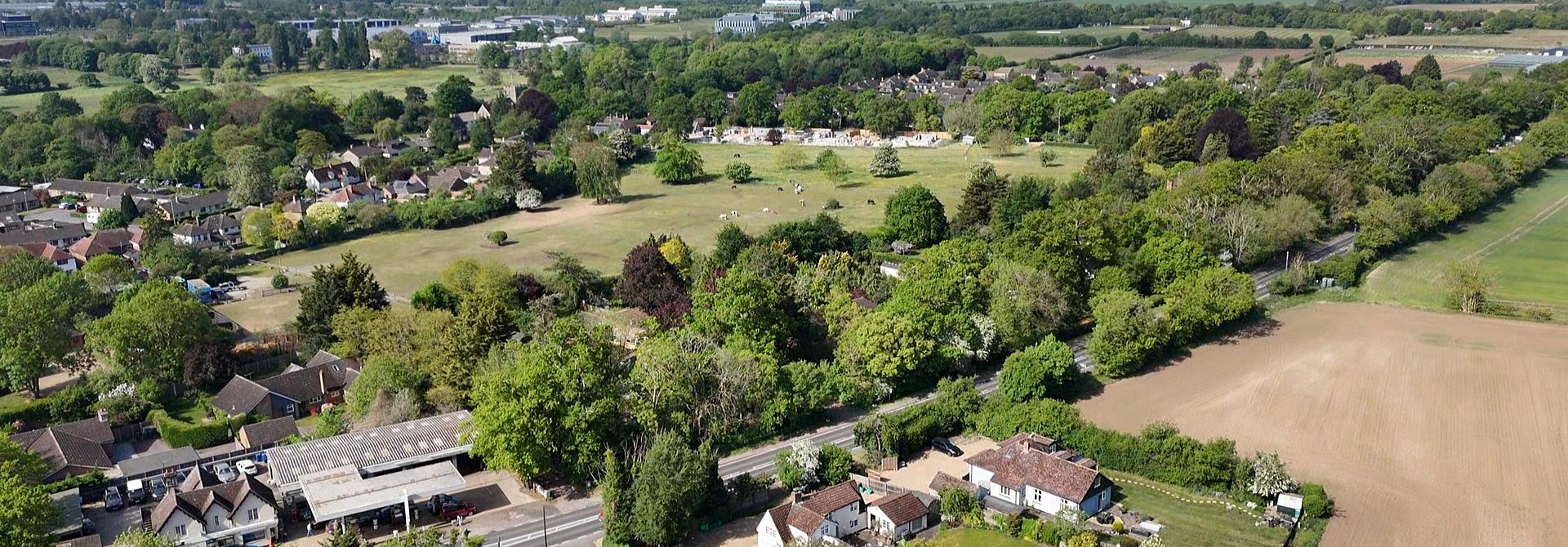
The Grange Farm site sits on some of the most sensitive chalk landscape in South Cambridgeshire — a gently rolling, elevated landform defined by long views, open horizons and a rural character unchanged for centuries.
The chalk landscape around the Abingtons is irreplaceable. Once built over, it cannot be restored — and the Council's own evidence rates the harm here as significant and impossible to mitigate.
The Council's own evidence (HELAA 2021) gives the site a 'Red' landscape rating — meaning development here would cause significant negative impacts that cannot be mitigated. In plain terms: the landscape would be irreversibly altered.
The Council's assessments acknowledge the development would "alter the existing landscape character irreversibly" and may cause "irreversible harm to the setting of Little Abington." Yet Policy S/GF provides no credible explanation of how this harm could be avoided.
Taken with other major projects along the A11/A1307 — including Kingsway Solar Farm and CSET — Grange Farm risks creating a continuous wall of development across South Cambridgeshire, urbanising the chalk hills and severing Cambridge from its rural hinterland.
From the highest points of Grange Farm, the land rises 30–40 metres above the Abingtons. Any large-scale development — even at two or three storeys — would be visible across the chalk hills, the Roman Road, Babraham, the Gog Magogs and beyond.
Viewshed analysis confirms a new town of 6,000+ homes would dominate the skyline, creating a permanent urban presence in open countryside. Night-time lighting would spread across the landscape, erasing the dark skies that define this rural edge.
The mismatch between the site's assessed capacity (2,883 homes at prevailing density) and the 6,000–8,000 now proposed raises further concerns. To reach these numbers, development would need to be far denser and taller than the landscape can absorb — intensifying visual intrusion and undermining claims of a "soft rural transition."
Mitigation is proposed only after the development is built — an approach that cannot protect a chalk landscape whose character depends on openness, subtlety and long-distance views.
SAVE is not against new homes. We are asking that no decision is taken until the evidence proves this can be done safely. Specifically:
Explain how allocation can be justified against the Council's own evidence of significant, unmitigable landscape harm.
Fixed controls in policy, set before approval — not mitigation promised after the town is built.
Independent visual assessment from the Roman Road, Babraham, the Gog Magogs and the wider chalk hills.
A demonstrated plan to prevent night-time lighting spreading across the rural landscape.
Test Grange Farm together with Kingsway Solar Farm and CSET for the risk of continuous urbanisation.